Posted on

Methods

ArcGIS

It allows me to make sophisticated spatial analyses, allowing me to overlay different data layers, calculate distances, create buffers, and (potentially) perform statistical analysis based on geographic data. This capability is invaluable for urban planning and environmental assessment, 

ArcGIS facilitates the integration of various types of data, including spatial data (such as maps and satellite imagery) and tabular data (such as databases and spreadsheets). This integration allows for comprehensive analysis and visualisation, providing a holistic view of the data. One of the standout features of ArcGIS is its ability to create compelling visualizations of geographic data. By generating maps I hope to effectively communicate spatial patterns and relationships across disparities in Zimbabwe. This is crucial for understanding what underpins equitable development in Zimbabwe

Tableau

Similar to the visualisations in ArcGIS, Tableau accomplishes statistical visualisations to understand the background of Zimbabwe in terms of demographics, economy, and inflation. Tableau excels in creating highly interactive and visually appealing dashboards. This interactivity enhances data exploration and understanding, enabling me to have a deeper insight into the limitations and opportunities of Zimbabwe. Beyond basic visualisation, Tableau offers advanced analytics features such as statistical analysis, and forecasting, which if used correctly could uncover trends, patterns, and relationships in my data; but in my project, this largely depends on the quality of the data I have access to
Posted on

Evaluating Sustainable Development in Zimbabwe

Lessons learned from sustainable economies around the
world

Zimbabwe is a landlocked country in Southern Africa with a
rich cultural heritage and diverse landscapes. From its vibrant
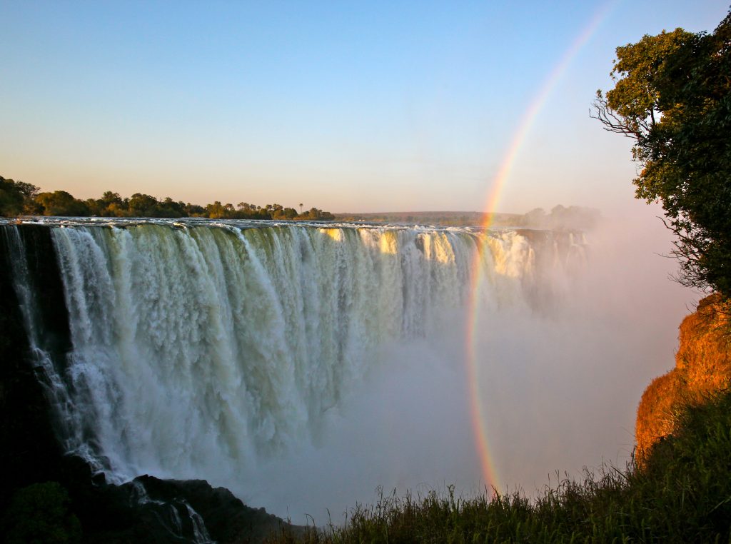
capital city Harare to the iconic ‘Mosi-oa-Tunya’ – ‘The Smoke
that Thunders’ (Victoria Falls), Zimbabwe captivates with its
extensive historical significance and natural beauty.
The country gained internationally recognised independence
in April 1980 after a long period of British colonial rule and 15
years of white-dominated minority rule.

Zimbabwe is divided into ten provinces, each with its own
distinct characteristics, cultural nuances, and economic
activities
*Two major cities: Harare and Bulawayo, have held
Metropolitan Provincial status since 1997
Zimbabwe has a diverse population with various ethnic
groups, including the Shona, Ndebele, Tonga, and many
others- boasting the most official languages in the world.
Historically, there have been tensions and challenges related
to ethnicity and representation, particularly in political and
socio-economic spheres. Ethnic segregation and disparities in
resource distribution remains challenges that the country
continues to address.

Posted on

The First of Many

I have lived in Zimbabwe for my entire life. A country plagued by macroeconomic volatility, corruption, and what can be deemed a human-induced famine, whose consequences have only been exacerbated by the effects of the enhanced greenhouse effect. Through my observations of the disparities between people and their food security, as well as the consequences of poor sustainable management my interest in environmental justice peaked. Given the large intersections between agriculture and mining- Zimbabwe’s largest economic sectors, I hope to deepen my understanding of their shared impacts on the environment. More specifically, through the Digital Scholarship Student Research Fellowship, I hope to deepen my understanding not just of the country, but also gaining the skills and knowledge on the best practices for the digitisation of information, and the processes that improve the accessibility of information.

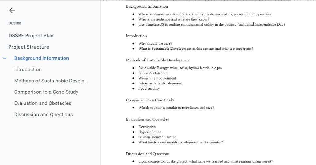
My research project (in its current iteration) is titled “Sustainable Development: A Concept or Feasible Reality for Zimbabwe”. By researching Zimbabwean Environmental Policy I hope to enrich my understanding of what educated these governmental systems but also how they manifest in Zimbabwean society. Case studies of both urban and rural sustainable development and green architecture will be used to evaluate their applicability within the country, but also help determine how these “foreign” solutions interact with already indigenous practices of environmental stewardship. I hope to view sustainable development as not only a solution to climate change at a global scale but also impactful to individuals at an interpersonal scale through food sovereignty, urban greening, women’s empowerment and the economic opportunities held within the various sectors in Zimbabwe. For example, one of the current environmental problems faced by the country is wetland depletion. Both poor environmental management, infrastructural development, and waste management systems have led to wetland collapse. Despite many individuals’ heavy reliance on this ecosystem for various purposes.

Though I acknowledge that growing up in a low-income country has hindered my access and proficiency with substantial amounts of software, I equally acknowledge how this presents an opportunity for me to grow abundantly throughout the summer. I look forward to potentially applying my interest through this project and improving the accessibility of information that is highly pertinent to Zimbabwe, and the entire African continent today. Helping individuals realise the potential of the country in its ability to progress.